
If you’ve ever tried selling, marketing or managing a large property portfolio, you’ll know that conventional ground photography only tells part of the story.
A beautiful cottage may look fantastic on its own.
An industrial unit may appear impressive from the front.
Two parcels of land may each have obvious value.
But what happens when all of those assets belong together?
That’s where professional drone property photography and aerial videography come into their own.
Recently I was asked to photograph and film a fascinating property portfolio consisting of:
- Two separate parcels of land
- An industrial unit
- A traditional cottage
- A river forming part of the property’s natural boundary
On paper, it sounded straightforward.
Once airborne, it became clear that the relationship between all of these elements was actually the story.
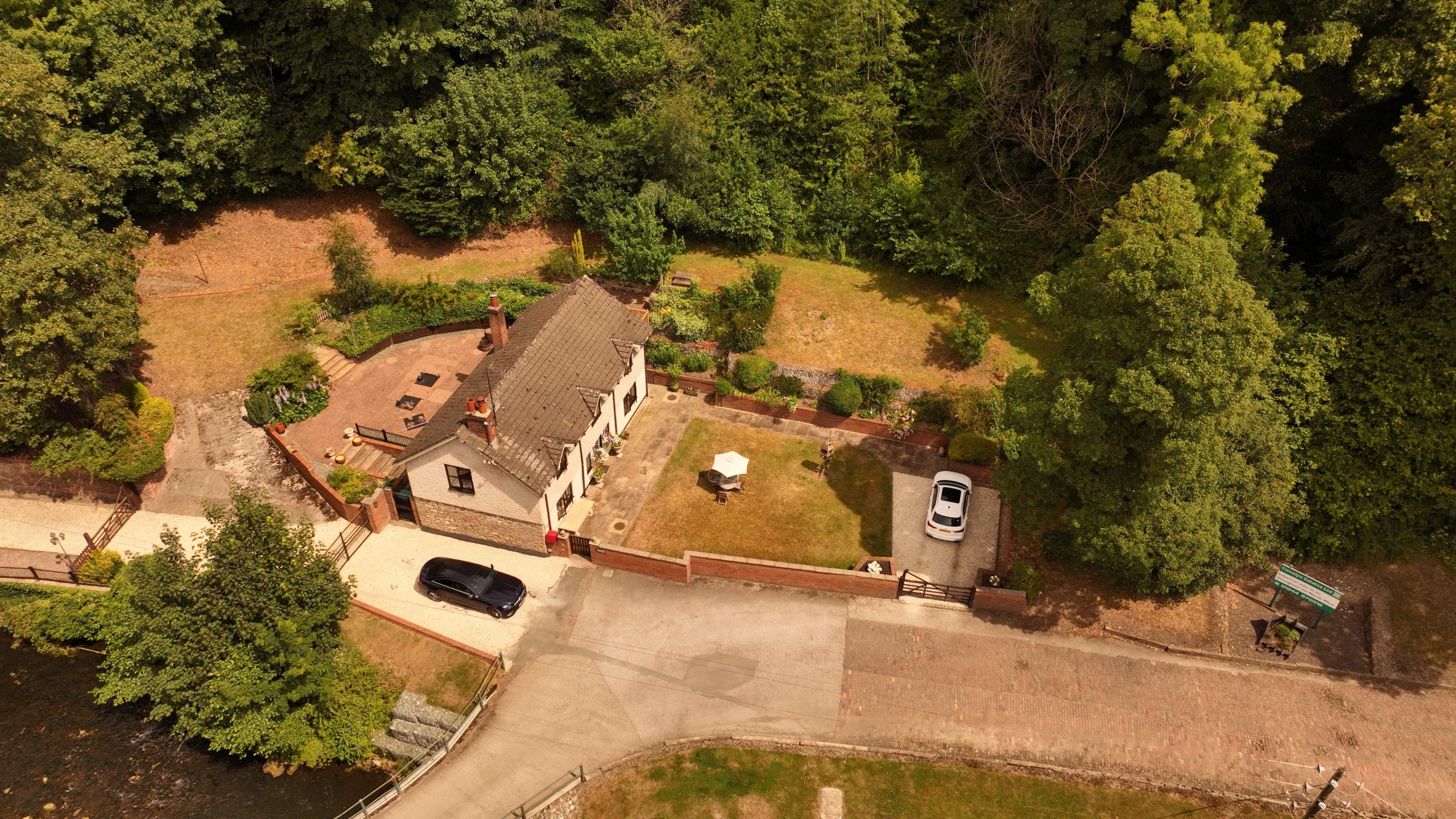
Why Ground Photography Wasn’t Enough
Estate agents and commercial property professionals often rely on traditional photography to market individual buildings.
The challenge with this portfolio was that its value wasn’t just in the buildings themselves.
It was in how everything connected together.
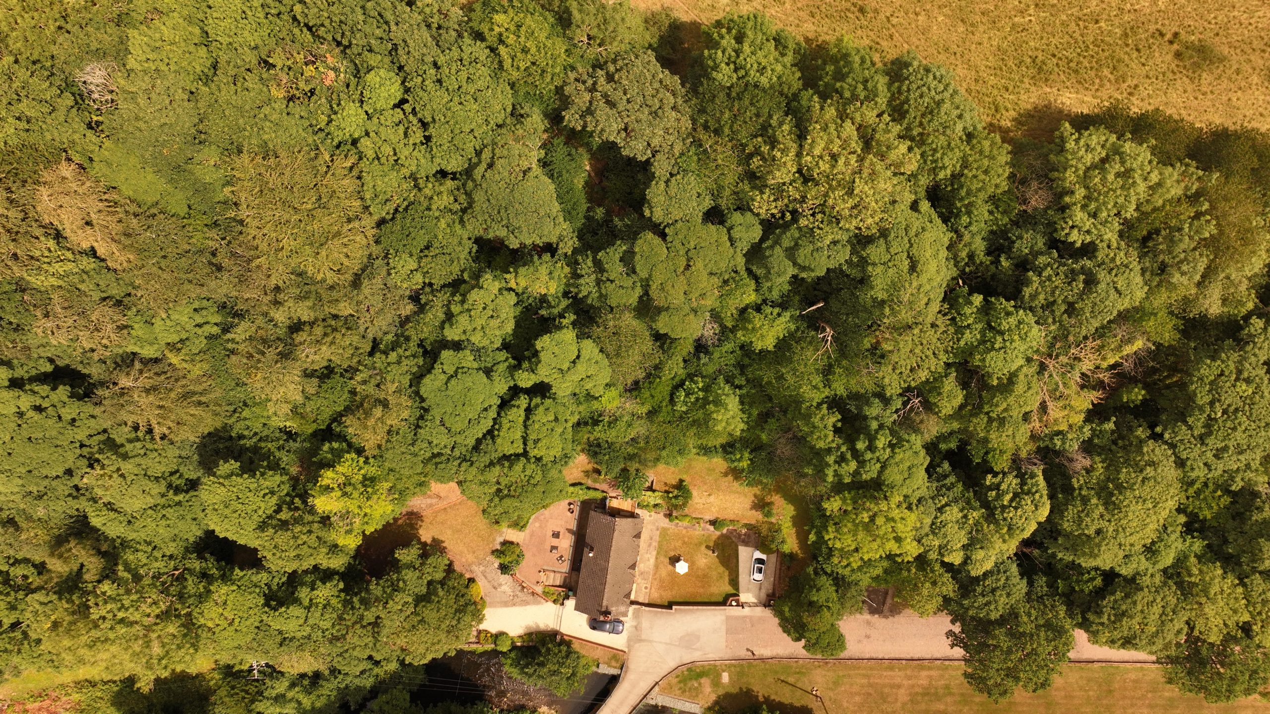
From the air, the industrial unit, surrounding land, cottage and river could all be appreciated within a single frame.
Suddenly, the scale of the site became obvious.
Potential buyers no longer had to imagine how everything fitted together.
They could see it immediately.
This is one of the biggest advantages of drone property photography.
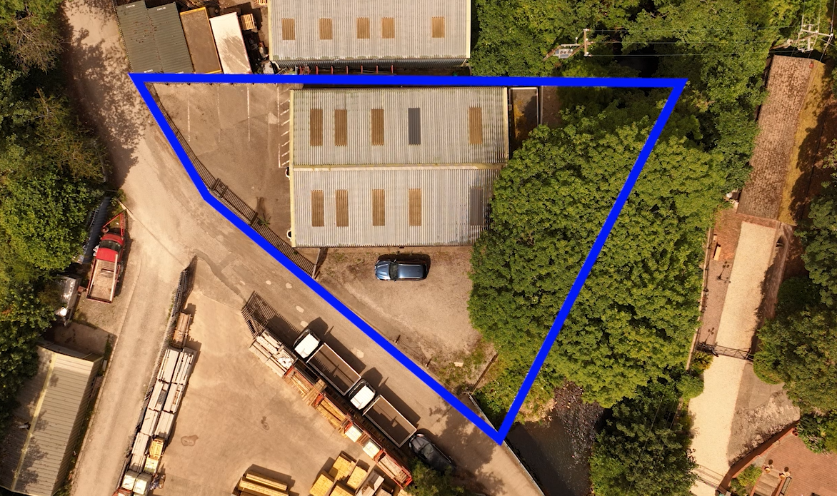
Showing Boundaries Clearly
One of the biggest questions buyers ask is:
“Where exactly does the property start and finish?”
Boundary lines can often be difficult to understand using title plans alone.
Aerial imagery makes this far easier.
By capturing high-resolution photographs from carefully chosen angles, viewers can quickly understand:
- Property boundaries
- Access routes
- Vehicle entrances
- Adjacent land
- Nearby infrastructure
- Rivers and natural features
For commercial property, this can save countless questions later in the sales process.
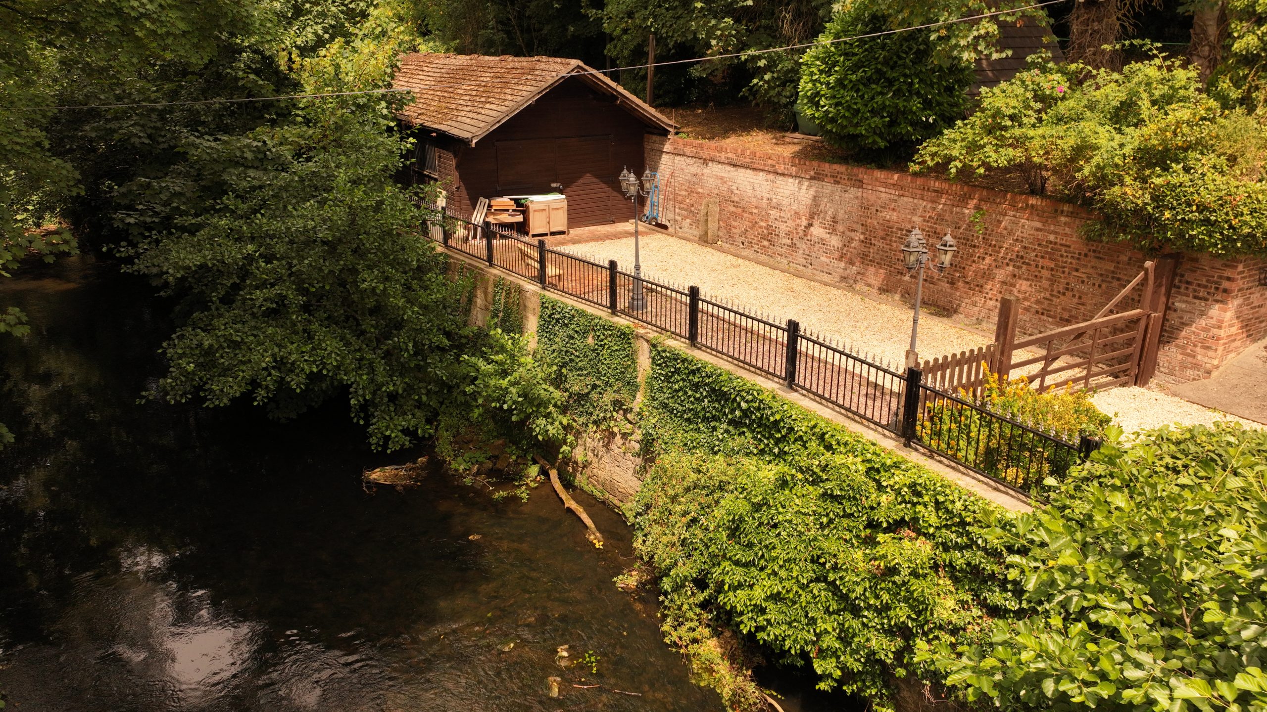
A River Can Be an Asset
One particularly attractive feature of this portfolio was the river running through part of the boundary.
Viewed from the ground, it was pleasant.
Viewed from above, it became a defining feature.
The aerial perspective showed:
- The natural setting
- Watercourse position
- Surrounding landscape
- Relationship between the land parcels
Rather than simply mentioning “river frontage” in a property description, the drone footage allowed prospective buyers to appreciate it instantly.
Sometimes a ten-second aerial clip explains more than an entire page of written text.
Why Experience Matters
Professional drone property photography isn’t simply about flying a drone.
It’s about understanding:
- Composition
- Light
- Storytelling
- Property marketing
- Commercial presentation
- Safety
- CAA regulations
Having worked in television and film for many years, I naturally approach every property as though I’m introducing it to an audience for the very first time.
What would they want to know?
What would impress them most?
Which shot tells the story best?
Those questions shape every flight.
Looking for Professional Drone Property Photography?
Whether you’re marketing a country estate, commercial premises, development land, industrial property or residential portfolio, professional aerial imagery can transform the way buyers see your property.
Based in North Wales, I provide drone property photography, aerial property videography, commercial drone photography, roof surveys, property inspections and cinematic aerial filming throughout Wales, Manchester, Liverpool, Cheshire and across the UK.
Since 2012, I’ve helped television productions, commercial clients and property professionals showcase locations from perspectives that simply aren’t possible from the ground.
Because sometimes, the best way to understand a property… is to rise above it.